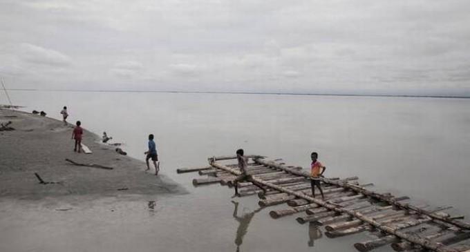
Who is Actually Polluting the Brahmaputra?

The claims of China building infrastructure on the Yarlung Tsangpo which have contributed to the turbidity of the water have dominated the media. Scientific data, however, points in another direction. The Yarlung Tsangpo flows for 1,625 kilometres on the Tibetan Plateau, it flows as the Siang, Dihang and Bramhaputra for 918 kilometres and for 337 kilometres as the Jamuna till it merges into the Padma. The river spans three countries and forms a large drainage basin where it is fed by other eastern Himalayan rivers. Most rivers on the Tibetan Plateau are fed by snow and glacial melt. The Yarlung Tsangpo originates from the Angsi glacier near Mount Kailash is also fed by snow and glacial melt as it flows on the Tibetan Plateau. According to available data, snow and glacial melt do not contribute significantly to the total volume of water as seen in India and Bangladesh.
The Tibetan Plateau falls in the rain shadow area. This means that there is barely any rain on the plateau as most of the rain falls on the southern slopes of the Himalayas (Kashmir to Arunachal Pradesh). On the Tibetan Plateau, the river receives much less rainfall as compared to the stretches in India and Bangladesh. During the period from December to February, the parts of the river flowing in stretches 3,000 metres above sea level receive snowfall. The south-eastern part of Tibet receives rain between July and August, which also contributes to the precipitation feeding the river.
In the trans-Himalayan zone, the annual precipitation averages 300 mm, whereas once the rivers cross the Himalayan crest line, the annual precipitation averages 5,000 mm. In the Assam valley, the average annual rainfall is more towards the northeast and gradually decreases towards the west. This makes it clear that a large part of the flow is generated on the southern slopes of the Himalayas.
Near Sadiya in Assam, three tributaries meet to form the Brahmaputra (Luhit, Dibang and Dihang). From the west, the Teesta also flows into the Brahmaputra to add to the total volume of water. At the great bend of the river on the Tibetan plateau, before it enters India, the peak flows are between 5,000 and 10,000 cubic metres per second (cumecs), whereas the peak flow at Guwahati is approximately 55,000 cumecs. Which means that during the peak season the flow on the Tibetan Plateau is roughly between 9 to 18 percent of the total flow. During the lean season, when the river is mostly fed by snow and glacial melt, the flow at Nuxia in the great bend is between 300-500 cumecs, while at Pasighat in Arunachal Pradesh it is around 2,000 cumecs, at Guwahati it is around 4000-plus cumecs, and at Bahadurabad in Bangladesh it is about 5,000 cumecs. During the lean season the flow on the Tibetan Plateau stands between 7 to 13 per cent of the volume at Guwahati.
The annual suspended sediment load near Nuxia in Tibet is around 30 million metric tonnes, whereas at Bahadurabad it is 735 million metric tonnes. Therefore, the large amount of suspended sediment load that gets deposited in the downstream to form a fertile Jamuna floodplain is created in India, where precipitation is almost 12 times higher than the rain shadow Tibetan Plateau.
What has caused the dangerous turbidity of the water, must be determined by the scientists, not by the politicians. Highway construction in Arunachal Pradesh may be a contributing factor, along with boulder mining. The Chinese government has denied any plans to divert river water through a 1,000-kilometre tunnel. The plan itself is ridiculous considering that the amount of energy required to divert the river water will be more than what can be generated from the run-of-the-river dams it has already constructed.
Get the latest reports & analysis with people's perspective on Protests, movements & deep analytical videos, discussions of the current affairs in your Telegram app. Subscribe to NewsClick's Telegram channel & get Real-Time updates on stories, as they get published on our website.


